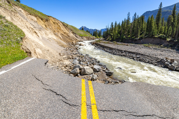
Flood hits Los Angeles following the wildfire

[The flood caused mudslides to sweep some areas. Photo Credit: rawpixel]
A strong storm struck Southern California on Thursday, February 13th, which led to a heavy rainfall throughout the region.
The intense rain caused flooding in parts of Los Angeles and triggered mudslides in certain areas.
The areas most impacted by mudslides were those directly affected by the massive wildfires that happened throughout January- the Palisades Fire and Eaton Fire.
According to information posted on February 11th on California Governor's Office of Emergency Services (Cal OES) website about the potential likelihood of mudslides, once a wildfire sweeps an area, the area is left charred by flames and becomes devoid of vegetation, also referred to as a burn scar area, making the soil unable to absorb water.
As the soil is not permeable to water, when intense rainfall hits a burn scar area, the water quickly runs off, picking up soil and debris along the way.
Because these areas were prone to floods, the National Weather Service issued flood watches for the burn scar areas of the Los Angeles region: the Pacific Palisade and Malibu region, which are under the burn scar created by the Franklin Fire from December 2024 and the recent Palisades Fire from January 2025, and the Altadena region, which was severely destroyed by the recent Eaton Fire in January 2025.
With the storm bringing more rain than had fallen in the past 9 months combined, the rain resulted in mudslides in the Palisades Fire scar, which swept across several roads and buildings of the region.
The uncontrollable flow of debris led to the Pacific Coast Highway, the famous road along the Pacific coastline, to close down near the Malibu area.
Moreover, the Mulholland Drive, an iconic road to Hollywood, experienced a heavy flow of mud around 8 inches deep.
Evacuation orders were issued in the Palisades Fire scar area, and the Eaton Fire scar area soon received similar orders.
However, the danger of flood and mudslide did not only apply to the burn scars of the recent massive fires in Los Angeles.
Other burn scar areas, like those formed by the Bridge Fire that happened from September to November of 2024, the Airport Fire that happened from September to October of 2024, and many more burn scars were at risk of mudslides potentially harming people and properties.
As large-scale wildfires growing more frequent in California, more areas have become prone to floods and mudslides, and this surge of ignition is closely tied to climate change.
Due to the warmer temperature, this area has been experiencing the worst drought ever recorded.
Drier environments make wild vegetation drier, making it easier to burn.
The fact that the rainy season of california is winter makes the situation worse since wildfires peak around October and November.
Daniel Swain, a climate scientist at UCLA, in his review article published in Nature on January 9, 2025, describes this phenomenon of rapidly swinging between extremely dry to wet as “hydroclimate whiplash.”
However, not taking any action because it seems inevitable does not help the case.
“Some of the most important risk-reducing interventions in the short term are not directly climate-related,” Swain notes in his blog post.
These actions include, “building codes that ensure construction of fire-resilient structures, more proactive vegetation management in/near communities, preventing unwanted fire ignitions under high risk conditions, and improving emergency communication and evacuation planning in high-risk locations.”

- Yujun Lee / Grade 11
- Homestead High School

![THE HERALD STUDENT REPORTERS [US]](/assets/images/logo_student_us.png)
![THE HERALD STUDENT REPORTERS [Canada]](/assets/images/logo_student_ca.png)
