One of the busiest hurricane seasons predicted by agency forecasters

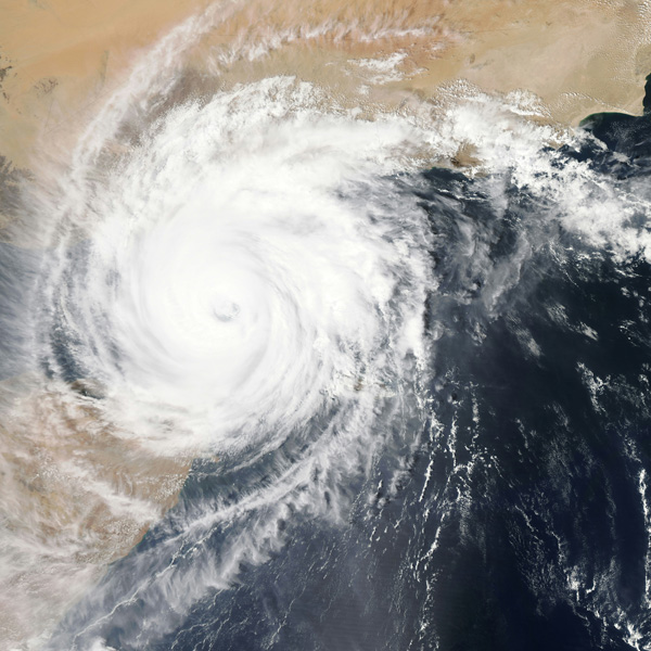
[Image of Hurricane. Photo Credit to Unsplash]
In a recent report, forecasters from the National Oceanographic and Atmospheric Administration (NOAA) predicted that this year’s hurricane season will be exceptional.
The 2024 hurricane season, running from June 1 to November 30, typically sees most of the activity occurring from August to October.
However, this hurricane season is expected to stand out significantly.
In early April, meteorologists from Colorado State University (CSU) predicted 11 hurricanes and 20 named storms would arrive in the United States, well above the average hurricane activity over the last 30 years.
NOAA’s subsequent forecast closely aligns with the CSU’s predictions, anticipating 13 hurricanes in total , with 7 major hurricanes of Category 3 or higher will bother US residents this year.
NOAA Administrator Rick Spinrad has issued an urgent call to action, emphasizing the need for for immediate preparation as this year's hurricanes and storms are shaping to be “extraordinary in a number of ways.”
The sharp increase in storm activity is attributed to an approximate 1°C rise in the North Atlantic sea surface temperature since 1991.
This additional heat contributes to the formation of large storms and increases the likelihood of them intensifying quickly.
Furthermore, the combination of warm sea surface temperatures and exceptionally dry and warm conditions of the South Sea can reduce wind production, creating an environment for hurricanes to develop and intensify.
The warming climate can further wetter hurricanes, exacerbating the impacts through increased side effects like flooding.
Given these climate factors and the high number of storms means communities along the Atlantic seaboard must be ready to act swiftly to face the severe weather.
This May, the water's surface of the Atlantic is typically expected to be warm in August.
A hurricane researcher at the University of Albany, New York, highlights the risk of rapid hurricane intensification near populated areas, making evacuation and preparation more difficult with less time.
In response to the expected hurricane season, NOAA plans to enhance its tracking capabilities by using underwater drones to monitor hurricanes in real time and promote quick responses to prepare for them.
In the past hurricanes, the lack of preparation has led to significant loss of life and property.
For example, during Hurricane Katarina in 2005, some residents underestimated the storm's severity based on their previous experiences with impotent hurricanes.
However, Hurricane Katarina was more devastating than many expected, leading to severe consequences.
Past data shows that some of the deadliest hurricanes, such as Hurricane Patricia in 2015, underwent rapid intensification just before they made landfall.
Therefore, despite the underestimating reports on most platforms, the wind speed reached 345km/h at its peak, causing more than $300 million in damage.
Even minor storms or hurricanes warrant full preparation from residents in the affected areas.
In addition, NOAA and other agencies provide resources and guidance on hurricane preparedness, and it is crucial to view them before fighting against the devastating season.
As we approach one of the busiest hurricane seasons on record, experts’ message is clear and concise: prepare immediately.

- Jaden Cho / Grade 11
- Asheville School

![THE HERALD STUDENT REPORTERS [US]](/assets/images/logo_student_us.png)
![THE HERALD STUDENT REPORTERS [Canada]](/assets/images/logo_student_ca.png)
